Between 14,800 and 10,500 years ago, the oldest petroglyphs in North America appeared in limestone at Winnemucca Lake. Today, the lake is a dry bed, but this spot was likely an oasis to some of the continent’s earliest inhabitants. They inscribed the rock with figures that might be trees, flowers, leaves, clouds, or lightning, symbols of the necessary connection to land and sky.
Winnemucca Lake inhabits a region that much later became known as Washoe, after one of the Indigenous groups who inhabited it. In their native tongue, the Wašišiw reflect the ancient modality of the petroglyphs: the moniker means “people from here.” So long had the group lived in the area that the land’s name merged with the people.
One might suitably assume from Winnemucca’s petroglyphs that Washoe was a verdant region, drawing in people to its cornucopia. This image belies, however, the more recent tale of humanity in Washoe, which we now call Nevada.
Winnemucca Lake petroglyphs - photo by Larry V. Benson, USGS
Despite the presence of the Washoe and others, such as the Paiute, Shoshone, Quoeech, and Walapai, the modern human story in Nevada is more akin to absence than population.
Unlike neighboring California, with its connection to the ocean, and nearby New Mexico, which was explored and inhabited by Europeans in the early 1600s, the non-Indigenous narrative in Nevada is shockingly sparse. While Santa Fe became the country’s first capital to be founded in 1610, Nevada’s counterpart – Carson City – barely beat the Civil War into reality. The state’s biggest and most famous city, Las Vegas, did not exist until 1905!
The first Europeans to explore Nevada did not reach the area until the 1770s, a surprisingly late date. We can attribute this fact largely to geography. Winnemucca Lake resides in the western portion of Nevada. A behemoth mountain range dominates the border with California, presenting a barrier to anyone looking to expand from the Pacific Ocean. This zone could support human life, thanks to the relative wetness of the mountains; to the east, however, lay a different geological saga.
Nevada takes its name from the range along the border, which the Spanish dubbed Sierra Nevada. This nomenclature translates to “snowy mountains.” So, Nevada means “Snowy.” Imagine the state today and this adjective probably does not readily emerge. Though the Sierra Nevada, which includes the highest point in the contiguous United States, does indeed get white, most people associate Nevada with another significant climate: hot desert.
Very hot desert.
So hot, so unforgiving that, unlike the creators of the petroglyphs and the Washoe, most humans avoided Nevada.
The Carson Range, a subsection of the Sierra Nevada that resides in the state named "Snowy" - photo by Skoolman
Nevada became part of the territory known as New Spain, as the Spanish pushed northward from Mexico in search of fresh claims. At the northern edge of this annexation and largely unsafe for human settlement, the Spanish did not produce much presence in Nevada. In 1804, Spain split the Province of the Californias into Baja California and Alta California. Lower (Baja) California became the region that now belongs to Mexico on the Baja Peninsula, while Upper (Alta) California included what would become the namesake state, Nevada, Utah, and parts of Wyoming, Colorado, and Arizona.
In 1821, Mexico won independence from Spain, which allowed them to claim Alta California. Following the Mexican-American War, the United States gobbled Nevada and the other parts of Alta California. Throughout this revolving door of control, only a smattering of humans lived in the Snowy Desert. The first permanent settlement in Nevada may not have been established until 1851! Around then, Mormons began to create stations on trails across the deserts that led to California, spurred by the gold rush. Eventually, the United States created the Utah Territory, including the land that is today Nevada. In 1861, the region officially adopted its current name, as the Nevada Territory separated from its eastern neighbor.
Nevada became the 36th state in 1864, as the second election of Abraham Lincoln neared. In order to enter the union before voting, officials sent the entirety of the new Nevadan Constitution to Congress via telegram, after several tries to mail physical copies failed. Using the nascent technology with the lengthy document cost more than $4,300 ($83k by today’s standards), which makes the transmission the costliest telegram of all time. In 1860, fewer than 7,000 people resided in Nevada. Thanks to a silver rush at the Comstock Lode, the population had risen to approximately 40,000 by statehood, still puny figures compared to other states.
Today, many trivia enthusiasts know that the least populated state is Wyoming. The landscape is so unforgiving in Nevada that, in 1940, it housed less than half the population of Wyoming at the time. Its World War II population level of 110,000 was by far the lowest of all the states.
New Spain in 1819 - graphic by Milenioscuro
The Old Mormon Fort in the Las Vegas Valley, constructed in 1855 - photo by Jrozwado
The borders in 1861 - graphic by Creysmon07
Though mining helped bolster populations in the Silver State a bit, things did not begin to exit the bottom of the list until a couple of other developments transpired.
1931 produced two catalysts. That year, construction on the Hoover Dam began, which created Lake Mead. This reservoir provided the opportunity to sustain many more people than naturally possible. Still, who wants to live in a desolate, baking desert? Add legalized gambling into the mix and the number of people volunteering to answer that question positively will change. The same year that dam construction started, “gaming” became synonymous with Nevada. Toss in the nation’s most relaxed divorce laws and people started flocking to the desert.
In 1930, 5,000 people resided in the Las Vegas area; today, that number is well over two million. As a state, Nevada has moved from 50th up to 32nd, with 3.1 million residents.
Las Vegas in 1952 - photo by Edward N. Edstrom
Hoover Dam - photo by Ansel Adams
The statistics back up the level of Nevada’s aridity. On average, the state receives just seven inches of precipitation each year, making it the driest state in the union! Unsurprisingly, with that little rain, things get hot. Laughlin, along the Arizona border, hit a record high of 125 degrees Fahrenheit in 1994. This maximum puts Nevada third on the list of all-time state high temperatures, after California’s Death Valley and Arizona.
Nevada is the seventh-largest state, approximately the same size as Spain. In an area of this scope, not everywhere will be as dry and hot as the extremes. In the places inhabited by the Washoe, rainfall can reach 40 inches. In the winter, many elevated places in Nevada become cold, supporting snow-capped peaks.
The Mojave Desert occupies the bottom third of the state. The driest and smallest of North American deserts, the Mojave typifies the stereotypical vision of Nevada. However, the rest of the state falls into other physiographics. The greater part of Nevada is comprised of the so-called Basin and Range Province, a massive zone that covers most of the American West and parts of Northern Mexico. This region follows a pattern, in which valleys and mountain ranges parallel each other, over and over. Driving through the innards of Nevada, one can experience this design for hundreds of miles. Because of this topography, Nevada should perhaps be known more for mountains than deserts. After Alaska, Nevada touts more mountains than any other state! Demonstrating the valley-mountain-valley-mountain pattern, 172 peaks in Nevada have more than 2,000 feet of prominence. The state possesses 314 named ranges! This place is a mountain lover’s paradise.
The High Point of the State is Boundary Peak, which garners the epithet because it sits along the border of California. This crag rises 13,147 feet (4,007 meters) above sea level, good for ninth on the list of state High Points.
Topographic map of Nevada, showcasing the many parallel basins and ranges - graphic by Jengod
The Basin and Range Province - graphic by Kathleen Smith
Boundary Peak - photo by An63ca
Nevada contains two National Parks. Great Basin National Park is entirely within the state’s borders, while a small portion of Death Valley National Park extends into Nevada. The country’s highest alpine and second-deepest lake – Lake Tahoe – forms part of the border with California. Across the state, bighorn sheep (state mammal) frolic among bristlecone pines and single-leaf pinions (state trees), while mountain bluebirds (state avian) nestle sagebrush (state flower). In the Mojave, the desert tortoise (state reptile) is a biological meteorologist. Striking sandstone (state rock) formations dot the landscape, sometimes rather close to the neon (state element) banners of Sin City.
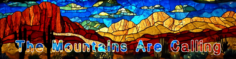
The Silver State seems to be a region of contradictions. It’s known for deserts, but its name means Snowy. We inhabited the region in the earliest moments of human presence in North America, but the climate resisted modern colonization later than most states. It contains the world’s glitziest city, yet outdoor marvels abound.
What happens in Vegas might stay in Vegas, but I propose we spread the word about the natural wonders of Nevada.