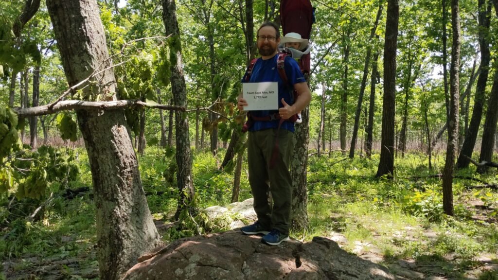
We do not often associate Missouri with altitude, but we learned the Saint Francois Mountains – a subset of the Ozarks – are an ancient chain of true, geological mountains. The highest point in these old crags is Taum Sauk Mountain. Rising 1,772 feet above sea level, Taum Sauk is Missouri’s ceiling.
Unlike the French influence on the etymological origins of the Ozarks and the St. Francois range, the interesting moniker of this mountain arrives via Indigenous roots. According to legend, the mountain’s name honors a Piankashaw leader. European settlers had a difficult time correctly pronouncing Sauk-Ton-Qua, so, over time, the common name morphed into Taum Sauk.
Plaque at the top of Missouri - photo by DEBFlounder
No one in the whole state of Missouri was higher than we were! - photo by Deborah Stout
The High Point sits within an eponymous Missouri State Park. Unlike some of the higher reaches of the St. Francois Mountains, Taum Sauk does not at all feature anything resembling a peak. Instead, the highest elevation resides on a ridge. Taum Sauk is one of the most accessible High Points. From the nearest parking lot, the path is ADA accessible and under half a mile long. A plaque marks the spot and its elevation.
Taum Sauk State Park offers much more than a simple jaunt to the loftiest point in Missouri, though. A spur of the Ozark Trail terminates at Taum Sauk. Continuing from the peak, one can visit some of the region’s prominent natural attractions. Just over a mile away is the state’s tallest waterfall, Mina Sauk Falls.
The falls are named for the daughter of Sauk-Ton-Qua, who stars in a legendary tale of star-crossed lovers. The beautiful Mina adored an Osage man but was forbidden to be with him. When Sauk-Ton-Qua discovered them together, he condemned the man to death. As he was executed on the side of the mountain, Mina threw herself onto the same rocks to die with him, covering the granite and rhyolite with blood. This act displeased the Great Spirit, who shook the earth, cracking the mountain. A stream emerged from the crack, creating the waterfall that is today named for Mina.
Mina Sauk Falls - Photo by Skye Marthaler
Continuing along the valley floor, the Ozark Trail reaches an absorbing geological feature. To continue along the trail, one must pay the fare at the Devil’s Tollgate! This passage is 50 feet long and 30 feet high, composed of volcanic rhyolite.
If one wanted to experience a “proper” summit of Taum Sauk Mountain, Devil’s Tollgate would be a great spot to end the outward journey on the Ozark Trail. From the valley at the Tollgate to the peak of Missouri, one would ascend approximately 675 feet.
During our visit over Memorial Day weekend 2022, we decided to add some more mileage by heading to Proffit Mountain. Just a mile and a half as the crow flies, the trail twists all over the St. Francois Mountains. Our jaunt turned into a 15-mile adventure. Normally, this stat wouldn’t be too bad. However, we had the family’s youngest trekker on our backs. Lest you duplicate our mistake, let me assure you the rugged Ozark Trail is not the place to more than double the mileage with which you have carried a child in a pack.
We certainly earned this High Point!
Devil's Tollgate - photo by Kyle Stout
You should have turned around here, dad! - photo by Kyle Stout
For those who prefer to remain a bit closer to civilization, Taum Sauk State Park offers a few other points of High-Pointing interest.
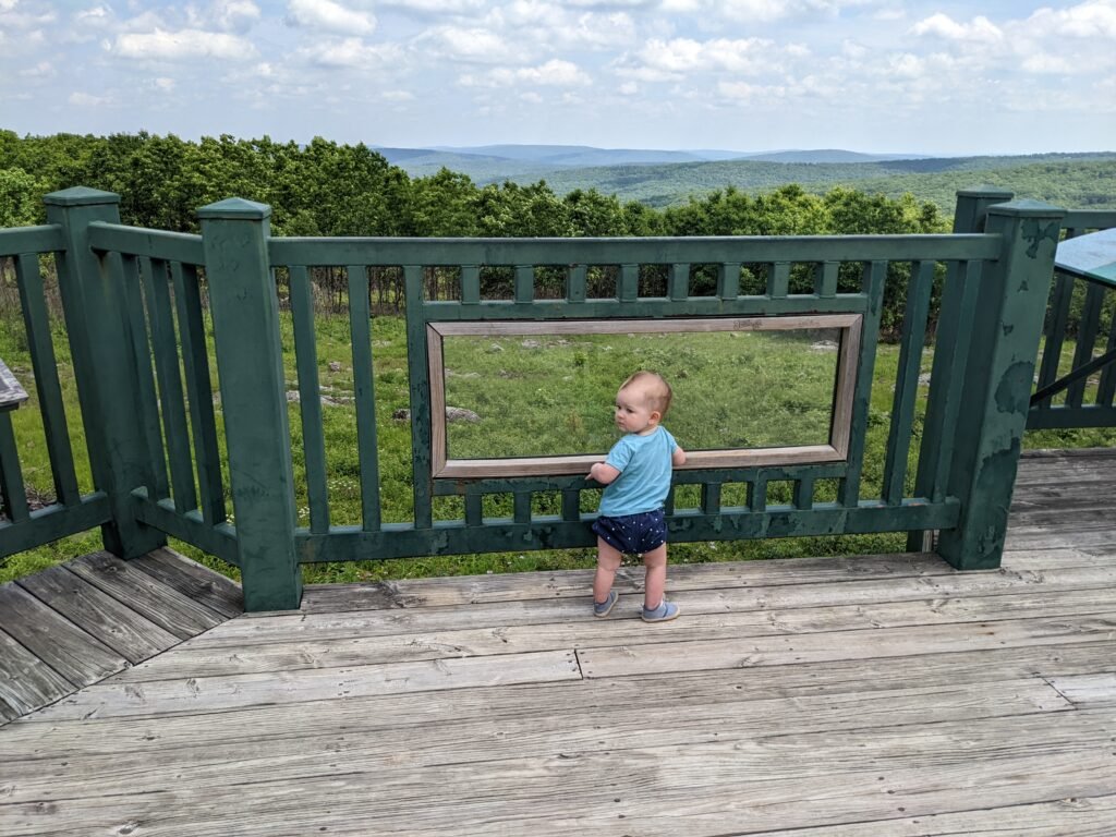
The apex of Missouri is covered with trees, so Taum Sauk lacks the traditional mountaintop views. However, a lookout tower provides gusty, gorgeous scenes of the Ozark forests and the St. Francois range. One can explore the many glades of the region. Glades occur where rocky outcroppings keep soil coverage low, producing spots more similar to deserts than forests.
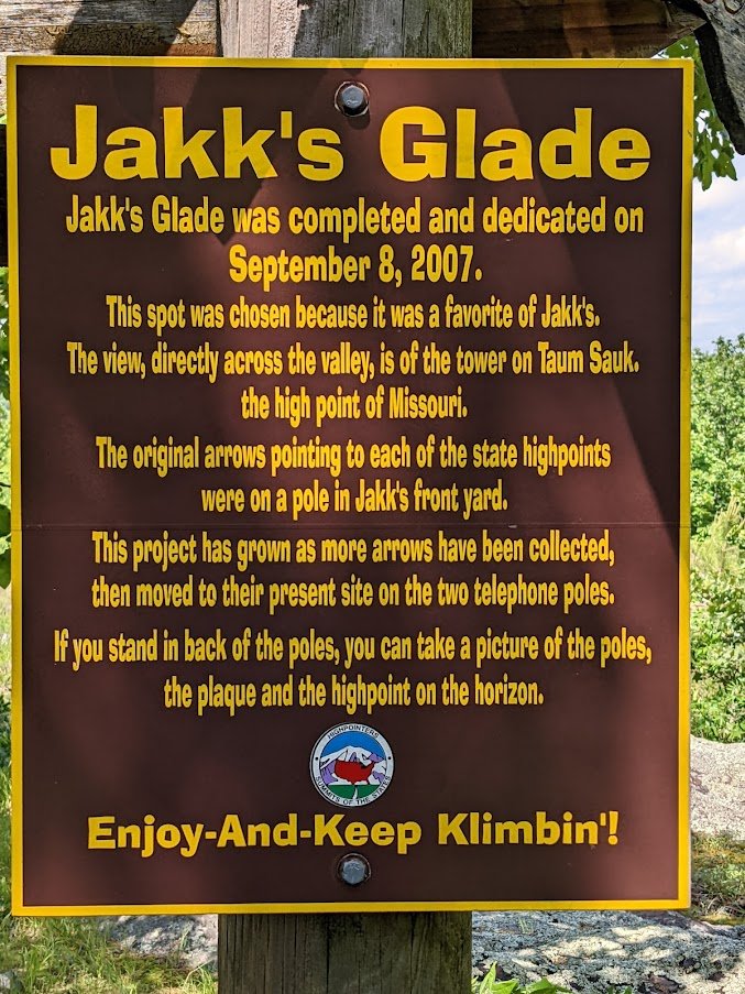
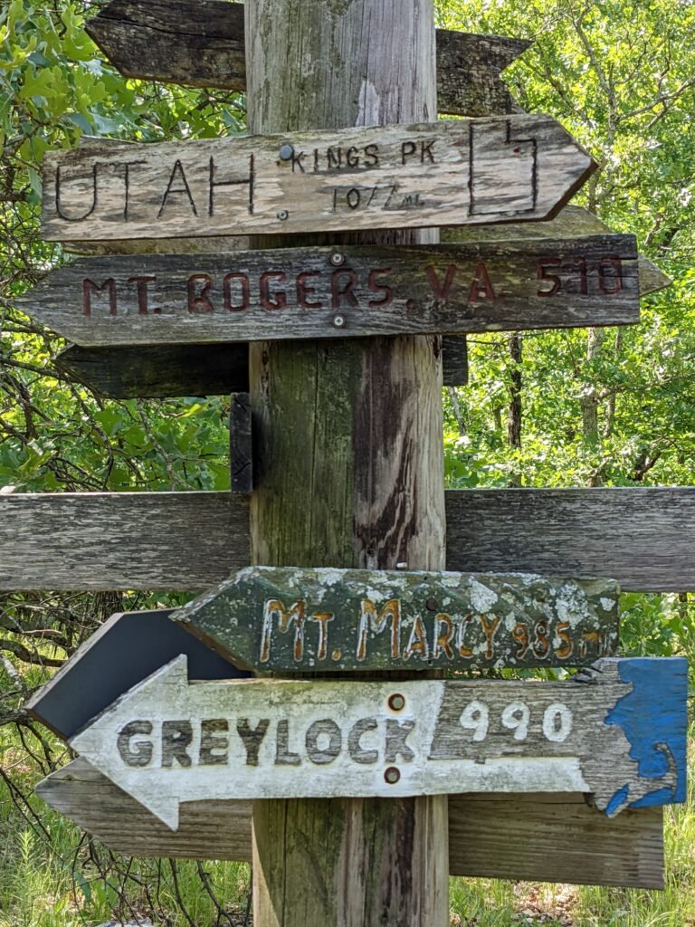
The founder of the Highpointers Club, Jack Longacre, apparently lived near Taum Sauk. His front yard featured a pole with arrows pointing to the various High Points across the United States. Today, in a spot he particularly enjoyed, the arrows and others added since his death serve as a nice monument to the man and the hobby.
Checking out the top of Missouri - photo by Kyle Stout
Learning about glades - photo by Kyle Stout
photo by Kyle Stout
Arrows point to all the High Points - photo by Kyle Stout
Only 3k miles to Denali - photo by Kyle Stout
Taum Sauk’s 1,772 feet come in at 41st on the list of the state High Points. Its peak and prominence certainly won’t win many glamor awards, but the region offers plenty for the aspiring adventurer.
We remarked multiple times along the Ozark Trail about how the rocks on which we marched seemed ancient. They appeared to be ordinary granite, but something seemed to emanate from them. Perhaps a wisdom of time and earth.
As we continue to explore the High Points of the United States, it’s remarkable that even the least glitzy locations offer plenty of history, beauty, and commune with nature.